Check access first.
Find current information from the landowner or official site manager. Respect closures and any permission requirements.

Urbex map & exploration logbook
The old factory. The forgotten fort. The place you always wondered about. Meet the atlas for a different side of the world.
Free on iPhone. Optional Pro subscription.
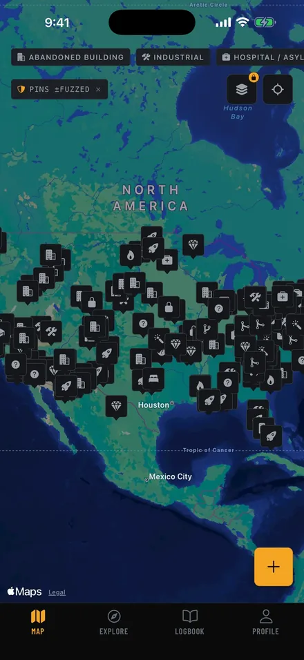
The atlas, in your pocket
Explore the record behind a place: its history, reported condition, photos, and the details worth checking before you go.
Discover documented abandoned and historic places. Browse categories and look beyond the routes you already know.
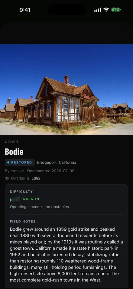
A name on a map is a starting point. Look for the source, the current status, and the date behind each observation.
Learn what a map record tells youA living record
Save the places that interest you. Keep a log of your visits. Add your own documentation, and help the next person understand what has changed.
Make your photos usefulA contribution is reviewed before it becomes part of the atlas.
Curiosity comes with responsibility
uMaps documents places. It does not grant access to them. These principles belong in every plan.
Find current information from the landowner or official site manager. Respect closures and any permission requirements.
Photograph what is there. Leave objects and surfaces as you found them, and follow the site’s rules.
Some community pins are deliberately approximate. Keep protected location details within the app’s rules.
A little preparation goes a long way
Work through a simple planning checklist. Keep your progress in this browser, or print a copy.
Field guides
Start here
A clear introduction to urbex, its history, and the importance of responsible access.
Read the guidePlan a visit
Start with public heritage sites, current visitor information, and verified permissions.
Read the guideRead the details
Understand the difference between a documented location and current access information.
Read the guideFor your next chapter
uMaps Pro opens exact locations and access notes on standard sites, adds Scout to survey an area, and brings satellite imagery, ranked sorting, and unlimited saves and lists.
Those same exact locations stay earnable for free. A key is minted when a site you documented with photos passes review, and the atlas opens to you at reputation 50. Keys and reputation are earned, never sold. The highest-risk sites (severe difficulty, or lethal hazards) are never for sale at all: they open on earned reputation alone, for every member.
Optional subscription. Current plans, local prices, and eligible trial offers are shown before purchase.
uMaps is an iPhone app for urban exploration. Browse documented abandoned and historic places, review site information, save places, and contribute to the community record. It is a directory and logbook, not permission to enter a site.
uMaps is free to download and explore, and exact locations can be earned for free with community reputation or a contribution key. An optional uMaps Pro subscription opens exact locations on standard sites and adds Scout, satellite view, ranked sorting, unlimited saves, and custom lists. Current prices and eligible trial offers are shown in the App Store and in the app.
You can browse the map and explore documented locations in the app. Coverage, detail, and the availability of records vary by area. Always check the current site status and access arrangements before planning a visit.
Sensitive community records use approximate pins to protect the location. On standard sites, the exact details open with earned community reputation, a contribution key, or uMaps Pro. The highest-risk sites open on earned reputation alone, for every member, and are never for sale. Open-data records are handled according to their source and license; learn more on our Open Data page.
Not necessarily. A historic or abandoned place may still be owned, closed, occupied, or unsafe. Check the official site manager’s information and obtain any required permission. A pin, photograph, or community note does not grant access.
uMaps is currently available for iPhone. Download it through the Apple App Store.

There’s more out there.
Open the atlas. Find a story worth knowing.
 Free to explore on iPhone. uMaps Pro is optional.